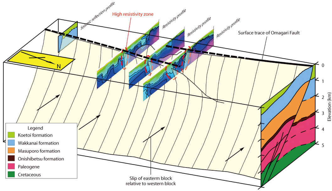
Fig.2-18 Inferred 3-D distribution of the Omagari Fault
The high resistivity zones in Fig.2-18 correlate with the rainwater infiltration zones, based on the data of resistivity and chlorinity of water taken from test boring. One of the high resistivity zones corresponds to the Omagari Fault inferred from a reflection seismic survey (not shown). Permeability along the Omagari Fault is estimated to be high, judging from outcrop occurrence along the Fault. Therefore, the high resistivity zone suggests infiltration of groundwater along the Omagari Fault and the stepped-diverging structure of the Fault shown in Fig.2-18 is inferred. The structure agrees with displacement direction of the Omagari Fault seen in outcrops.
Go back by your web browser, or click the right button. « Close