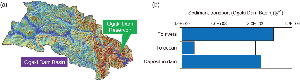
Fig.1-13 (a) The Ogaki Dam Reservoir (map drawn using DEM data provided by the Geophysical Survey Institute) and (b) the simulation results for the amount of sediment movement in the basin
A large amount of soil erodes and moves as sediment during a flood, entering into water systems, such as rivers and reservoirs. Most of the sediment is then deposited on the reservoir bed. The results indicate the importance of the reservoir to Cs migration.
Go back by your web browser, or click the right button.« Close