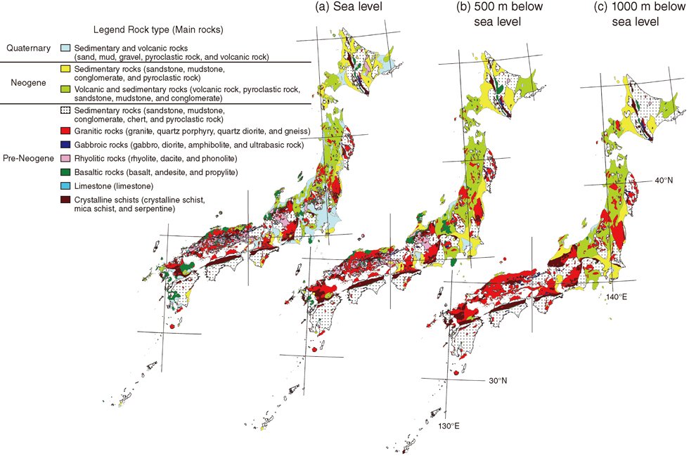
Fig.8-22 Subsurface geological mapping of the Japanese Islands
Horizontal slices at sea level (a), and depths of 500 m (b), and 1000 m (c) below sea level throughout the Japanese Islands showing the distribution of various rock types.
Go back by your web browser, or click the right button.« Close