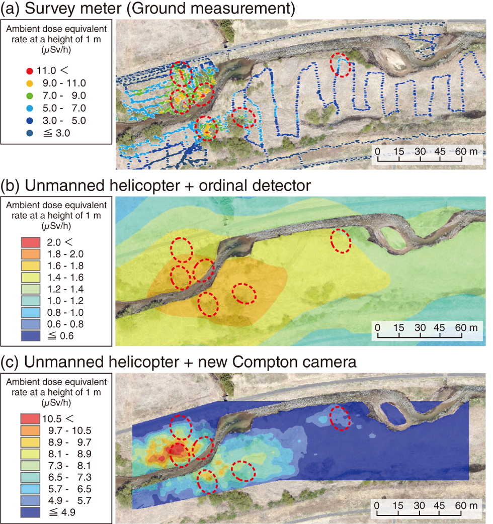
Fig.1-22 Ambient dose-equivalent-rate map
The ambient dose-equivalent-rate maps at a height of 1 m indicated the measured results using (a) the survey meter in the ground measurement, (b) the unmanned helicopter and the ordinal detector, and (c) the unmanned helicopter and the new Compton camera. To facilitate comparison, hot spots are indicated with red-dashed ellipses. The precise measurement performance of the new Compton camera was confirmed from the test results.
Go back by your web browser, or click the right button.« Close