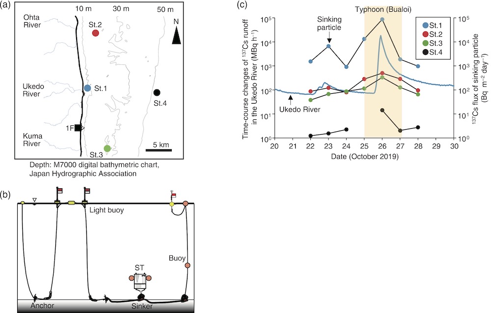
Fig.1-26 (a) Measurement area, (b) methodology, and (c) results summary
(a) Four observation points (St.1-4) were set off the coastal area of Fukushima Prefecture. The lines represent the water depth. (b) Sediment traps were moored at each observation point to collect sinking particles. (c) Comparison of the time-course changes of 137Cs runoff in the Ukedo River (blue line) and the 137Cs flux of the sinking particles captured by the sediment traps.
Go back by your web browser, or click the right button.« Close