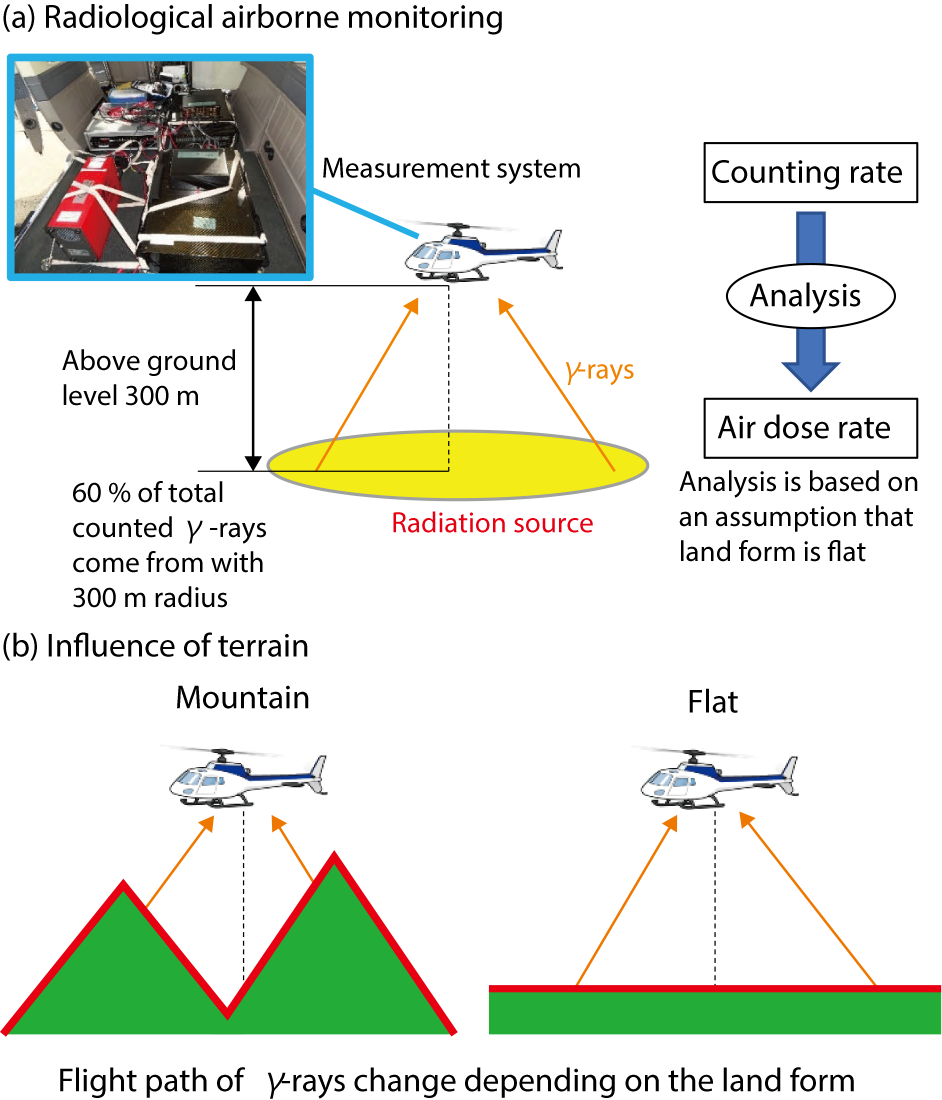
Fig.1-26 Effects of topographical relief upon radiation measurement
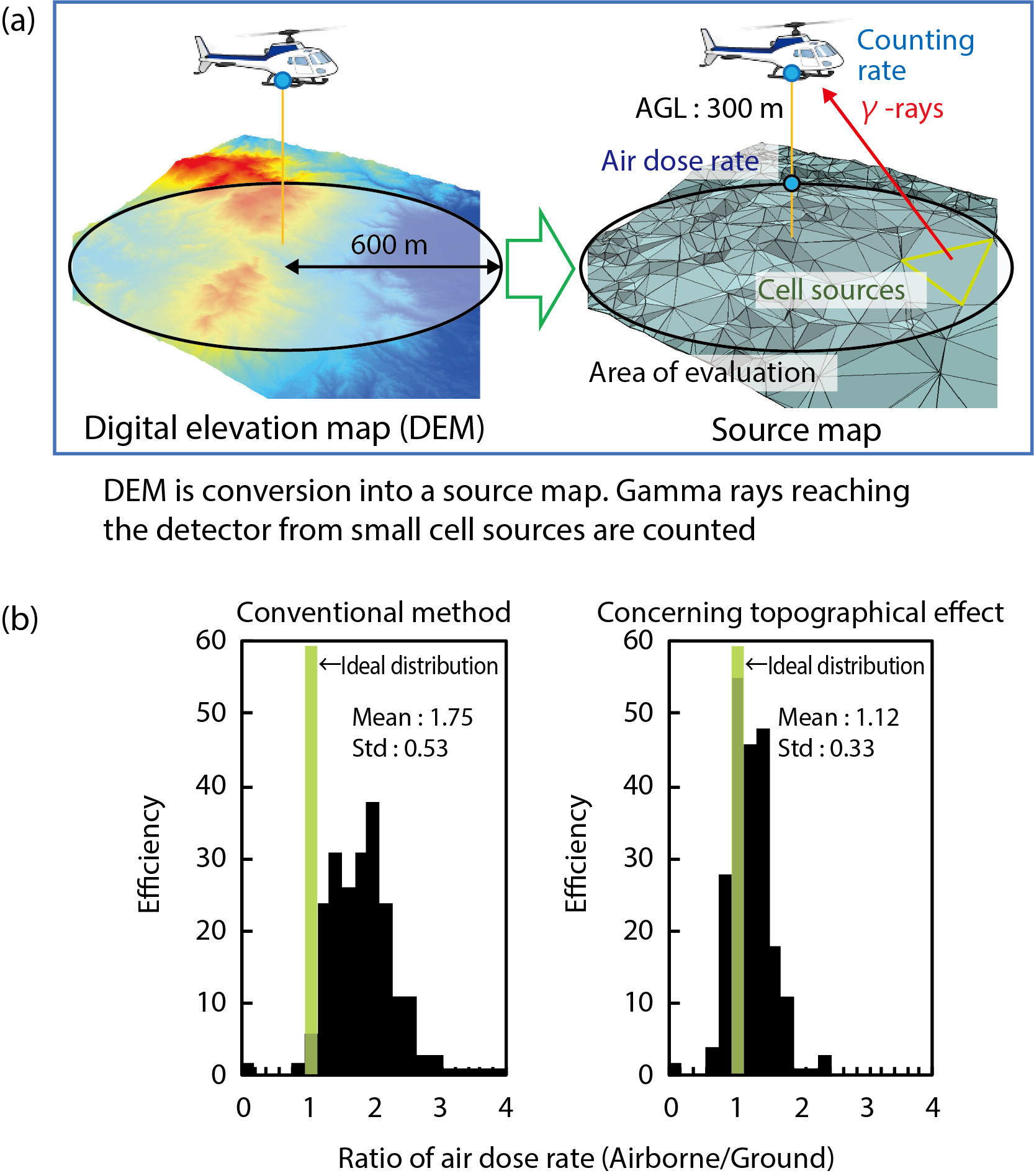
Fig.1-27 Data-analysis method incorporating terrain effect, and the results
Radiological airborne monitoring is one radiation-monitoring tool that can measure air dose rates and radionuclide deposition rapidly over a wide area by measuring radiation at 300 m above the ground (Fig.1-26(a)). In radiological airborne monitoring, not only manned helicopters, but also unmanned helicopters, drones, and other flying objects are used. Measurement results collected by radiological airborne monitoring are employed for a number of purposes including assessment of the contamination situation. Recently, the measurement result has also been used to estimate inhabitantsüf exposure dose. Therefore, improvement of data accuracy is regarded as one of the most important issues.
In radiological airborne monitoring employed to date in Japan, the terrain of a target area has been regarded as flat in the process of data analysis. However, due to topographical relief, the air dose rates may potentially be overestimated or underestimated, because the measured counting rates change depending on the terrain effect in spite of having the same contamination level (Fig.1-26(b)). Unlike Europe and the United States, most of Japan’s land area is covered by mountains. Therefore, we evaluate the effects of terrain upon data accuracy and develop a new method to decrease the error.
In the analytical process, an air dose rate (µSv/h), D, can be obtained by dividing a counting rate (cpm), C , by a conversion factor (cpm/(µSv/h)), CD, according to the following equation:
D = C ⁄ CD
CD changes depending on the terrain. We performed data analysis considering the terrain effect. CD values for arbitrary terrain were obtained based on the calculated results of γ-ray flux at 300-m height. Gamma-ray flux was calculated as shown in Fig.1-27(a). First, a triangle-surface map was created from a digital elevation map. Then, small triangles in this map were regarded as small radiation sources and generated γ-rays. In the end, by summation of the number of γ-rays that reach to the detector position at a height of 300 m, the counting rate was obtained.
For 217 points in Fukushima prefecture, we compared D obtained with the traditional method and D obtained with the new method including the terrain effect to D obtained by ground measurement and evaluated the conversion accuracy. In the evaluation, the frequency distributions of the ratio between the radiological-airborne-monitoring and ground-measurement D values were used. If the two D values were equivalent, the distribution shows as a green bar in Fig.1-27(b). From the frequency distribution, the average was improved from 1.75 to 1.12 and the standard deviation was improved from 0.53 to 0.33 using a new analysis method considering terrain effect. By considering the terrain effect in data analysis, we succeeded in improving conversion accuracy.
We are going to apply this method to the regular operation of radiological airborne monitoring in Japan.

