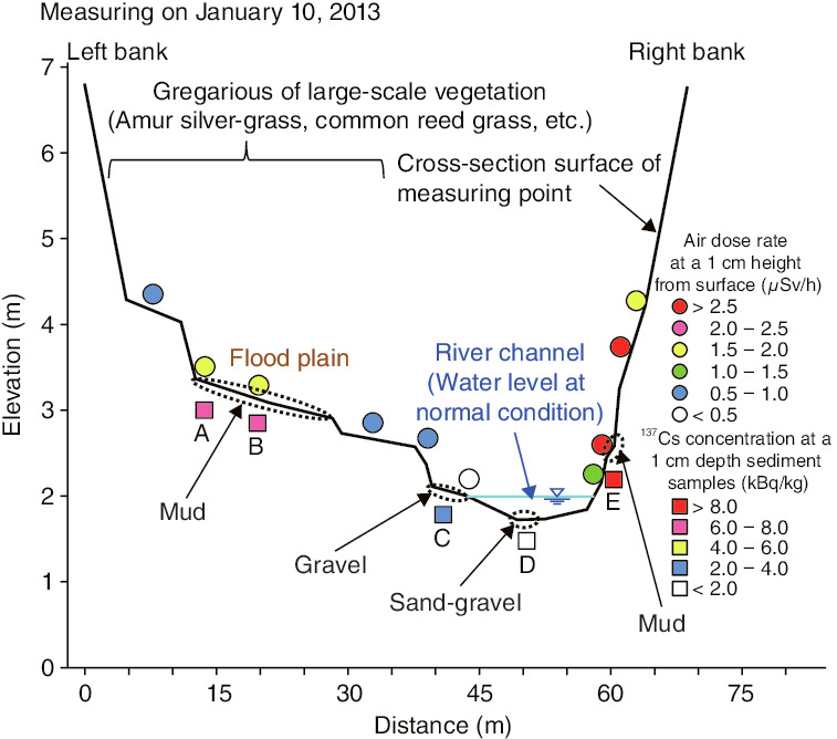
Fig.1-33 The results of field investigation around a river channel
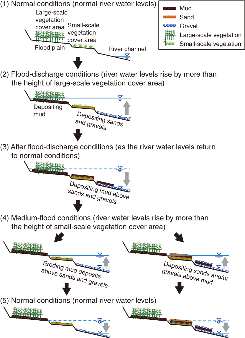
Fig.1-34 Conceptual model for the redeposition and transport mechanisms of radiocesium
Since forest covers approximately 70% of the area of Fukushima Prefecture, it is presumed that the radiocesium (Cs) released into the atmosphere by the accident at the TEPCO’s Fukushima Daiichi NPS (1F) was widely deposited in forests. As decontamination in mountain forests is not feasible, soil particles containing Cs transported from forests to the flood plains by river flow can potentially increase the local radiation dose around rivers. Prediction of the transportation and deposition behavior of Cs by the river flow using numerical analysis will be helpful for eliminating or reducing movement routes for Cs, leading to a reduction in the future exposure dose. To apply numerical analysis to this prediction, it is necessary to clarify the phenomenon by field investigation and to construct a conceptual model capable of explaining its mechanism. We conducted field investigations at 130 measurement points at 5 rivers around 1F.
From the results of field investigations, it was observed that muddy sediments deposited on the flood plain have high concentration of Cs, while the sand and gravel sediments deposited at the edges or bottoms of river channels have low concentrations of Cs. The spatial distribution of Cs is heterogeneous around river channels (Fig.1-33).
Based on the results of field investigations and rainfall and river-water-level-fluctuation data in Fukushima Prefecture, a conceptual model for the redeposition and transport mechanisms of Cs in rivers was constructed (Fig.1-34).
This mechanism is as follows.
(1) Under normal conditions: Cs does not move and the distribution of Cs does not change.
(2) Under flood-discharge conditions (during typhoons): mud can be deposited in the flood plain, because the water depth there is shallow and river-flow velocity decreases due to friction with large-scale vegetation.
(3) After flood-discharge conditions: suspended mud is deposited in a wide range of flood plains.
(4) Under the medium-flood condition: mud deposited at the edges of the river channel is eroded by the river flow with a medium water level. Another possibility is deposition of sands and/or gravels above the contaminated mud, thereby shielding against radiation.
(5) Return to normal conditions.
Based on this conceptual model, we will continue research to establish analytical-prediction methods for the transport and deposition of Cs due to water discharge in rivers.

